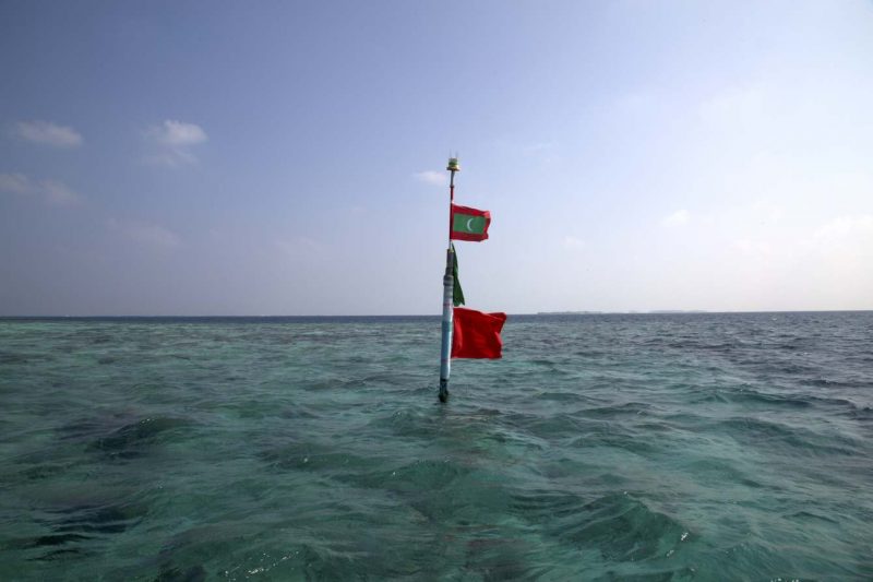
Hōkūleʻa Canoe
The Polynesian, double-hulled canoe launched on March 8th, 1965. The first voyage began in 1976 from Hawaii to Tahiti using Polynesian navigation. Secondly, the voyage was set out to explore the anthropological theory of the Oceanic people (indegenious people who lived around the Pacific Ocean). Today, the Hōkūleʻa Canoe has sailed over 140,000 miles across The Great Ocean to different countries such as Japan, Brazil, Australia.

“By participating in the dive and honoring our veterans while also considering the deeper history that the Hawaiians had with Pearl Harbor, I am attempting to honor all of it [the history]. This project is honoring history, honoring our ancestors and tying it [the history] all together.”
-Jane Chang Mi
Tahiti
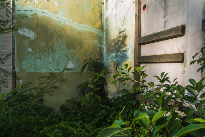
Le Goût de la Pureté
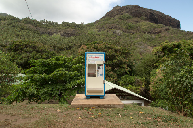
Le Goût de la Pureté (The Taste of Purity), 2014; archival inkjet print; 32″ x 48″ – Credit to Jane Chang Mi

In The Taste of Purity (2014), Jane Chang Mi highlights the French motto for aquasmart (the brand of the water purifier in the photo), as it is the name of the photograph. The need for a water purifier & “taste of purity” in the jungle of an island in the Pacific Ocean is something that concerned Jane and was the reason behind this photograph. Some questions that resulted after Jane’s discovery of the aquasmart purifier included the following, as she transcribed on her website:
“Why in the middle of the jungle on an island in the middle of the Pacific Ocean is a water purifier necessary? Has the water table disappeared due to global sea level rise? Did the nuclear testing affect the water reserves? What is the taste of purity and what is impure?”
Jane Chang Mi on “Le Goût De La Pureté.”
Un Parfum Comme Rien D’autre
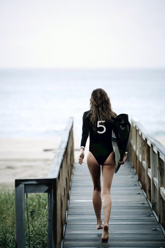
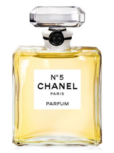
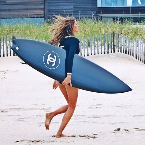

In her piece A Perfume Like Nothing Else (2014), Jane especially wanted to comment on the perfume released by CoCo Chanel, Chanel No. 5. This French brand’s slogan for their newest perfume at the time of this photograph, “a perfume like nothing else”, struck Jane after some of their released advertisements for the perfume. The advertisements depicted a model named Gisele Bundchen surfing in a specially designed bathing suit, showcasing a “5” on the back, and on a sleek black surfboard with the iconic Chanel emblem printed on it. The way that CoCo Chanel made surfing so lavish and French, when in reality it is a traditional Polynesian sport, was significant to Jane. The archipelagos were not characterized by the lavish smell of Chanel No. 5 in reality. In actuality, Jane realized during her visit to Tahiti that in fact the air carried the smell of burning trash due to the imported goods the Fa’a’ā Airport having no place to be disposed of.
Et Quelle Est Votre Idée du Bonheur?
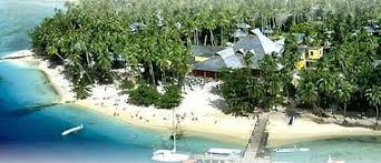

When explaining her inspiration behind naming and taking a photograph of a run-down resort in Tahiti, entitled What Is Your Idea of Happiness (2014), Jane explained that “What is your idea of happiness?” is the slogan for a French based all-inclusive resort called Club Med. Many of the tourists who visit such places usually take advantage of the all-inclusivity given by the resort and don’t wander too far from their resort and its many amenities or their tiki huts. Thus, the underlying meaning Jane Chang Mi was trying to emphasize with this photograph definitely has to do with tourism in Tahiti. Not only has it completely warped Tahitian economy from the barter-system it was once based on by its indigenous people as discussed earlier, but tourists don’t actually see Tahiti for what it actually is. They have little exposure to actual Tahitians and the culture on this island.
Hawaii
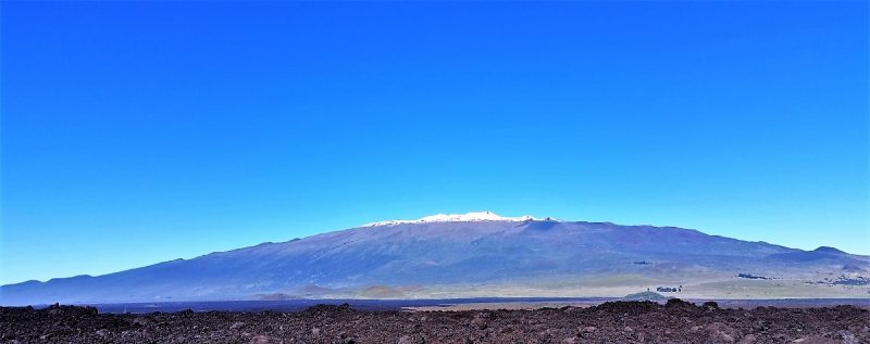
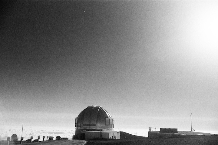
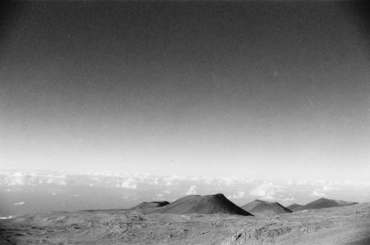
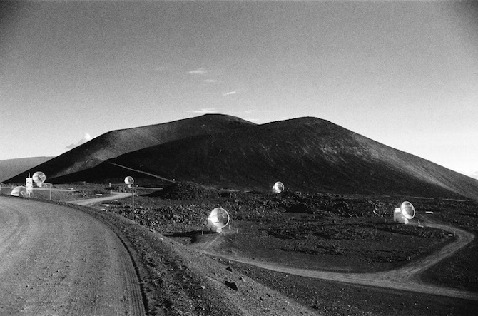
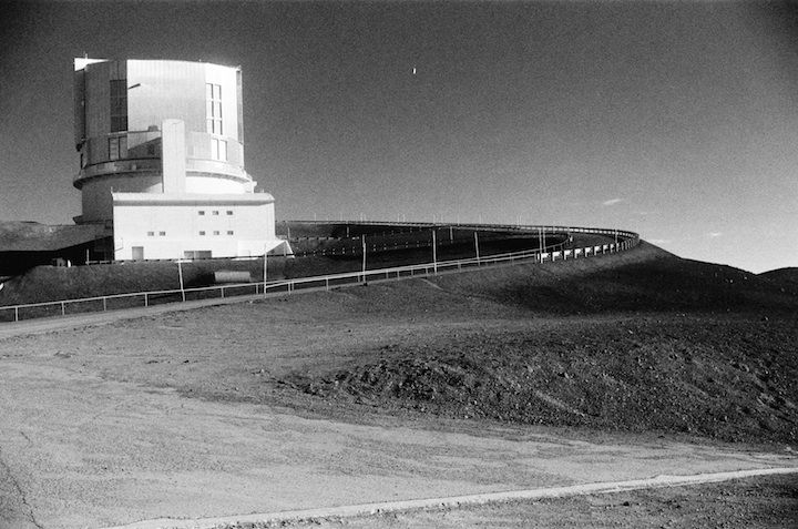
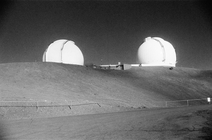
Mauna O Wākea ~ Sky Father
“I have been to protests. My son, for his one-year-old birthday party we went to a protest.-or we didn’t go to a protest but we went to the gathering to see the Ku Kia’i at Mauna Kea.”
Kū Kia'i Mauna Kea
Protect Mauna Kea
Stand Guard over the Mountain
As someone who is passionate about science, history, and culture, what is your opinion on TMT at Mauna Kea now that more protests have happened?
“That’s a good question. I don’t think it’s for us to say. I’m not Hawaiian and I think that the Hawaiians should be in charge of not only that land, but what goes on, on that mountain. That makes the most sense to me. I mean there are very very few places where indigenous people still have access to their land all over the world and really care for it and they should be supported. And so anything we need to do and we can do to support Hawaiians and their care for their land is what should be done.”
Jane Chang Mi
“Scientific colonialism is problematic because it is a repeat of colonialism yet in a more subtle and disguised form, using science to justify the use of land. Specifically, in the case of Mauna o Wakea, there have been many questions as to how the TMT project will further desecrate the sacred. Moreover, there is a lack of acknowledgement in the scientific community that these astronomic discoveries happen on Hawaiian land. This then begs the question, why are people who are not natural or local stakeholders of the land given excess decision-making power about how to use the land?”
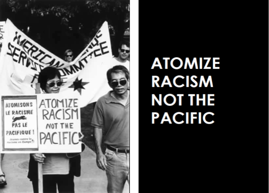
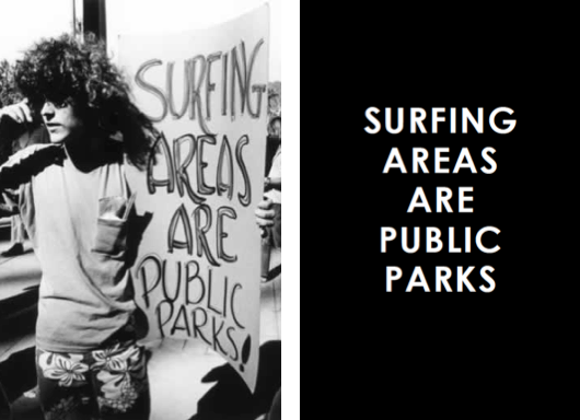
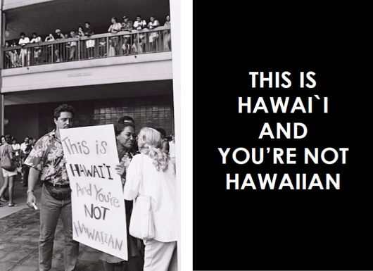
The Spirit Of Aloha
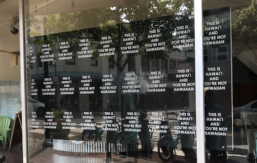
Jane Chang Mi did a collaborative project with photographer Ed Greevy, she named “The Spirit of Aloha”. Aloha is a lifestyle practice of loving and respecting your neighbor. In this print/installation Jane uses Greevy’s photos of activism and community in Hawaii. Jane uses Greevy’s photos of protest signs and remakes them. Focusing in on different times, places and problems that the community was battling. These remade protest signs reflected on the importance of public beaches from the native surfers, the bombing in the Pacific, the destroying and demolition of land for construction purposes. The installation showed the remade protest sign next to the original Ed Greevy photograph for background on the pieces. This installation gives a modern twist on historical controversies. This spin allows you look at how far we have come as a society also observing how very far we may not have gotten in certain problems.
Jane Chang Mi used to go to Hawaii over the summers when she was little. Her grandfather was a waterman. She started traveling to Hawaii on her own in high school. She has lived in O’ahu on and off for over period of time in her life.
Marshall Islands
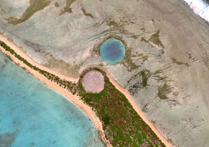
Upon first look, the photograph of Cactus Dome 2017 evokes a sense of wonderment. The two craters, one in the middle of land, filled with sea-water, and the other appearing to be a plain patch of land. The symmetrical landforms create a distinct spatial imagery. The picture above is a result of a series nuclear tests on the Enewetak Atoll. Runit Island is 1 of 40 islands of the Enewetak Atoll of the Marshall Islands. It now exists as a radioactive waste repository left by the United States. The circle that appears to be land is actually a concrete dome encapsulating tons of radioactive debris, including plutonium which is a toxic heavy metal harmful to environmental and human life.
(See Reverse Side.) Exhibition
Jane Chang Mi’s exhibition, “(See Reverse Side.)” highlights the inhabitants of the atolls depicted in the National Archives and Record Administration (NARA), and how the U.S. military plays the largest role in the destruction of the Marshall lands, the Pacific ocean, and the livelihood of the Marshallese people. The photos below are re-drawings, by Jane Chang Mi, of the archived photographs that depicted islander life on the atolls.
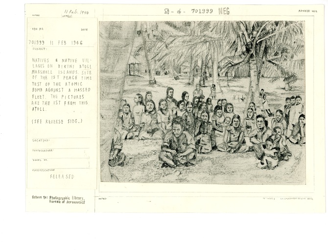
Margin Notes: “NATIVES & NATIVE VILLAGES ON BIKINI ATOLL MARSHALL ISLANDS. SITE OF 1ST PEACE TIME TEST OF THE ATOMIC BOMB AGAINST A MASSED FLEET THE PICTURES ARE THE 1ST FROM THIS ATOLL.”
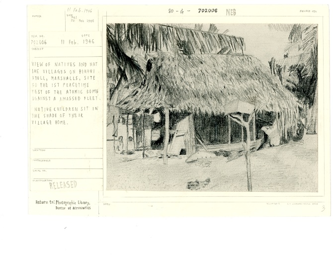
Margin notes: “VIEW OF NATIVES AND NATIVE VILLAGES ON BIKINI ATOLL, MARSHALLS, SITE FOR THE 1ST PEACETIME TEST OF THE ATOMIC BOMB AGAINST A AMASSED FLEET. NATIVE CHILDREN SIT IN THE SHADE OF THEIR VILLAGE HOME.”
The first drawing showcases somewhat of a “class photo” of villagers from Bikini Atoll. It makes the viewer wonder how they felt that day taking the photo, and where they are now? Did they know their home would be destroyed? The photos indicate two things to the reader: natives and village infrastructure existed on the island, and Bikini Atoll will be the site of the first “Peacetime” test of the atomic bomb. The term “Peacetime” is ironic as the result of nuclear destruction and the displacement of thousands is anything but “peaceful”. The voices of the actual people depicted in the archived photos remain silent.
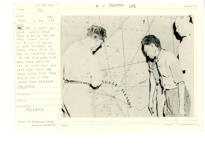
Margin notes: “CHEIF JOMATA KAPUA STUDY A MAP OF THE MARSHALL ISLAND TO SELECT ATOLLS TO WHICH TO MOVE RESIDENTS OF BIKINI ATOLL PRIOR TO THE 1ST PEACETIME TESTS OF THE ATOM BOMB TO BE HELD THERE EARLY MAY BY JOINT ARMY AND NAVY TASK FORCE ONE. CHEIF KAPUA RULES OVER BIKINE AND A HALF DOZEN OTHER NEIGHBORING ATOLLS”
Reading the margin notes about Chief Kapua and his involvement in evacuating Bikini Atoll for nuclear tests creates a false perception that there was a choice involved. It is the practices of U.S. imperialism that support the destruction of the homes of the vulnerable. There is not much history covering the Marshall Islands and the Marshallese culture prior to the 1970s, making it more difficult to understand if the islanders were even in a position to oppose the agenda of the U.S. military. Jane Chang mi highlighted this moment in history because it is important to value the cultural integrity of people that are forcibly subject to the negative affects of both climate change and nuclear warfare.
“Perception has the analysis and almost interpretation behind that critical analysis”
Jane Chang Mi